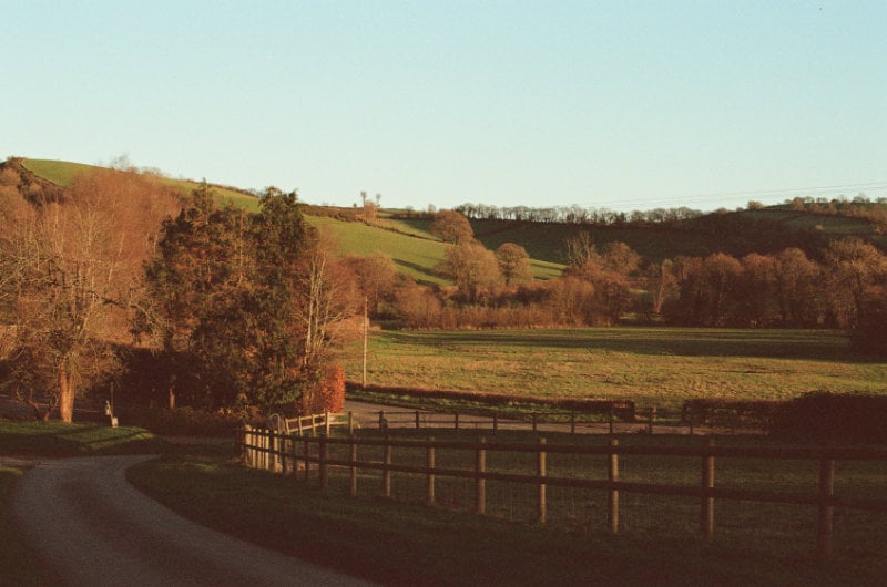
A recreational farm in Northern Missouri can provide hunting, fishing, camping, trails, family retreats, agricultural income, and long-term land ownership. However, the value of a property depends on much more than its acreage or the amount of timber shown in listing photos.
Northern and Northeast Missouri have a distinctive mixture of cropland, pasture, wooded draws, creek corridors, ponds, brush, rolling terrain, and rural building sites. These transitions between open ground, timber, water, and cover can create appealing recreational properties. They can also introduce questions involving leases, access, drainage, boundaries, maintenance, and year-round usability.
Two farms with similar prices and acreage may provide completely different experiences. One may have quiet hunting access, diverse habitat, a dependable pond, usable trails, and a practical cabin site. Another may have seasonal roads, difficult creek crossings, limited wildlife cover, unreliable water, or active farm agreements that affect recreational use.
Boyer Land Company is based in Memphis, Missouri, and has direct experience with farms throughout Northern and Northeast Missouri. Its core service area includes Scotland, Knox, Shelby, Adair, Macon, Sullivan, Linn, Monroe, and surrounding counties.
This guide explains what buyers should evaluate before purchasing recreational land in this part of Missouri.
Tell Boyer Land Company How You Want to Use the Land
1. Start With How You Plan to Use the Property
Begin with activities rather than acreage.
A buyer focused on deer hunting may prioritize habitat diversity, neighboring land, quiet access, timber, bedding cover, and food sources. Someone looking for a family retreat may care more about roads, utilities, cabin potential, water, trails, and driving distance from home.
Your goals may include:
- Deer or turkey hunting
- Fishing
- Camping
- Hiking
- ATV or side-by-side riding
- Wildlife viewing
- Building a cabin
- Establishing a permanent residence
- Creating a family retreat
- Combining recreation with agricultural income
- Holding land for long-term family use
Separate your preferences into three categories.
Features the property must already have
These may include legal access, a particular location, minimum acreage, utilities, an existing cabin, mature timber, or a dependable pond.
Features you can add later
These may include trails, food plots, campsites, hunting blinds, storage buildings, or a cabin.
Features that are difficult to change
Location, neighboring land, topography, legal access, flood exposure, and deed restrictions are generally much harder to correct than an overgrown trail.
This exercise helps prevent an impressive listing photo from distracting you from what you actually need.
2. Evaluate Wildlife Habitat as a Complete System
A wooded property is not automatically a quality hunting property.
Wildlife habitat depends on how food, water, cover, terrain, neighboring land, and hunting pressure work together. Northern Missouri’s combination of agriculture, grassland, timbered draws, brush, and creek corridors can create useful habitat edges, but every property must be evaluated individually.
Food
Identify agricultural fields, native vegetation, mast-producing trees, browse, food plots, and neighboring food sources.
Ask whether the property provides food during different seasons or whether wildlife primarily travels elsewhere to feed.
Water
Ponds, creeks, springs, wetlands, and livestock water sources may support wildlife. Determine whether a creek or pond holds water throughout the year or becomes unreliable during dry conditions.
Cover
Look for bedding areas, brush, young timber, native grasses, creek corridors, timbered draws, and areas where wildlife can avoid disturbance.
A property consisting entirely of mature open timber may provide less ground-level cover than expected.
Travel corridors
Timbered draws, creek bottoms, fence lines, field edges, ridges, and narrow sections of cover can influence wildlife movement.
Brushy draws extending into agricultural fields can be especially valuable because they connect cover with food sources while also breaking up larger open areas.
Neighboring property
Study the surrounding landscape, not just the acreage being sold.
Ask:
- What is planted on neighboring farms?
- Where are nearby roads and homes?
- Is adjoining land heavily hunted?
- Are neighboring farms managed for wildlife?
- Does the property connect to larger blocks of habitat?
- Could future development affect privacy?
A smaller tract connected to larger habitat may provide better recreational possibilities than an isolated property surrounded by heavy disturbance.
Hunting access
Consider how you would reach stands, blinds, food plots, and different parts of the property without disturbing the areas you intend to hunt.
Look for access routes along field edges, ridges, creeks, or perimeter trails. Consider prevailing winds, parking locations, gates, and how agricultural activity may affect entry.
3. Inspect Ponds, Creeks, and Water Features
Water can add significant recreational value, but buyers should determine whether it is dependable, healthy, accessible, and maintainable.
Evaluating a pond
Inspect:
- Approximate size and depth
- Dam and spillway condition
- Signs of leakage
- Bank erosion
- Sediment buildup
- Aquatic vegetation
- Water clarity
- Fish populations
- Livestock access
- Watershed condition
- Trees growing on the dam
- Evidence of burrowing-animal damage
A pond containing water does not necessarily support quality fishing. Shallow water, low oxygen, excessive vegetation, sediment, and unbalanced fish populations can limit recreational use.
The Missouri Department of Conservation provides information about pond construction, maintenance, fish populations, and water quality.
Evaluating creeks and drainage areas
Determine whether the water is:
- Permanent
- Seasonal
- Intermittent
- Dependent on recent rainfall
- Subject to flash flooding
- Accessible from the property
- Shared with neighboring land
- Located in a mapped flood-hazard area
A creek may provide beauty, wildlife habitat, and a natural travel corridor. It may also divide a property or restrict access after heavy rain.
Walk creek crossings and low areas. Look for washed-out trails, unstable banks, debris lines, erosion, and evidence that water regularly leaves the channel.
Use the FEMA Flood Map Service Center for preliminary flood research, then supplement those maps with surveys, local knowledge, insurance research, and appropriate professional guidance.
4. Determine How Much of the Acreage Is Usable
Acreage tells you the size of a property, but not how easily you can use it.
A 100-acre farm may contain steep slopes, wet bottoms, crop ground, pasture, dense brush, timber, trails, water, and potential building sites. Its total acreage and recreationally usable acreage may be very different.
Inspect:
- Elevation changes
- Steep slopes
- Wet ground
- Erosion
- Creek crossings
- Timber density
- Existing clearings
- Field edges
- Trail condition
- Equipment access
- Food-plot locations
- Campsites
- Potential building sites
Evaluate the trail system
Existing trails are useful only when they reach the parts of the property you want to access.
Determine whether the trails:
- Connect major property features
- Accommodate an ATV or side-by-side
- Are wide enough for maintenance equipment
- Cross wet or erosion-prone areas
- Require bridges or culverts
- Remain usable after rain
- Provide quiet hunting access
- Can be maintained economically
Restoring an overgrown trail may be manageable. Constructing a new trail across steep, wet, or heavily wooded terrain may require much more work.
5. Confirm Legal and Practical Access
Do not assume an existing driveway, trail, or road provides permanent legal access.
Confirm whether the farm has:
- Direct frontage on a public road
- A recorded access easement
- A private shared road
- A road-maintenance agreement
- Gates or restricted entry
- Seasonal road limitations
- Bridges, culverts, or low-water crossings
- Access for emergency vehicles
- Access for construction and maintenance equipment
Ask who maintains the road and how expenses are divided among neighboring owners.
A road that is comfortable in dry weather may become difficult during snow, spring thaw, or heavy rain. Visit under less-than-perfect conditions when possible.
Legal access and practical access are separate questions. A property may have a recorded easement that is too narrow, steep, wet, or poorly maintained for your intended use.
Have title documents, easements, and access rights reviewed by qualified professionals before purchasing.
6. Investigate Cabin and Building Potential
A scenic clearing is not automatically a buildable site.
Before assuming you can construct a cabin, home, shop, or storage building, investigate:
- Local zoning
- Deed restrictions
- Building requirements
- Road frontage
- Legal access
- Flood exposure
- Soil limitations
- Septic suitability
- Well requirements
- Electric availability
- Utility-extension costs
- Driveway construction
- Slope and drainage
- Emergency access
- Existing easements
The USDA Web Soil Survey provides mapped soil information and interpretations involving building sites, roads, septic absorption fields, drainage, and erosion.
Soil maps are useful for preliminary research, but they do not replace onsite testing, permitting, engineering, or a professional evaluation of a specific building site.
Calculate the complete improvement cost
A remote cabin site may require more than the structure itself.
Potential expenses include:
- Clearing
- Grading
- Driveway installation
- Culverts
- Electric extension
- Well construction
- Septic installation
- Propane
- Internet service
- Foundation work
- Tree removal
- Drainage improvements
A less expensive property can become more costly when infrastructure must be extended deep into the acreage.
7. Verify Boundaries, Surveys, Easements, and Ownership Rights
Online maps and listing overlays are useful for preliminary research, but they are not substitutes for a survey or title work.
Determine:
- Whether the property has been surveyed
- Whether survey markers can be located
- Whether fences follow the legal boundaries
- Whether neighboring structures or roads encroach
- Which easements affect the property
- Who can cross the land
- Who maintains shared access
- Whether utilities cross the property
- Whether timber or mineral rights have been separated
- Whether another party holds hunting, farming, grazing, or access rights
An easement gives another party a specific right to use part of the property. That right may involve a roadway, utilities, pipelines, drainage, or another purpose.
Review every recorded easement and determine how it could affect privacy, hunting, construction, trails, and future resale.
Do not assume an old fence establishes the legal property line. Missouri fence and boundary questions can be complicated. Consult a surveyor, title professional, or Missouri attorney when boundaries are uncertain.
The University of Missouri Extension provides a general Missouri Fence and Boundary Law Reference Guide.
8. Review Existing Leases and Land-Use Agreements
A recreational farm may be subject to agreements that continue after the sale.
These may include:
- Farm leases
- Hunting leases
- Grazing agreements
- Timber contracts
- Conservation contracts
- Access agreements
- Utility easements
- Crop-share arrangements
- Residential leases
Ask:
- Is the agreement written or verbal?
- When does it expire?
- Does it transfer to the buyer?
- Who has the right to use the property?
- Are any areas excluded from the owner’s use?
- Who maintains roads, fences, and waterways?
- Are there penalties for ending the agreement?
- Has proper notice been given?
- Are payments current?
A farm lease may provide income and maintain open ground, but it can affect food plots, hunting access, trail placement, and when the owner may use certain areas.
Conservation programs may support habitat and provide income. They may also include management requirements and land-use restrictions. Verify the actual contract rather than relying only on a listing description.
9. Estimate Maintenance, Insurance, and Improvement Costs
Recreational land still requires management.
Expenses may include:
- Property taxes
- Liability insurance
- Cabin or building insurance
- Road maintenance
- Gravel
- Mowing
- Trail clearing
- Tree removal
- Fence repair
- Pond management
- Dam and spillway repairs
- Culverts and crossings
- Food plots
- Invasive-species control
- Building repairs
- Utilities
- Equipment storage
- Gates and security
Look for deferred maintenance such as:
- Washed-out roads
- Damaged culverts
- Failing bridges
- Pond-bank erosion
- Unsafe structures
- Dead trees near buildings
- Abandoned wells
- Dump sites
- Damaged fences
- Overgrown trails
- Eroded slopes
- Unmarked hazards
Discuss coverage with an insurance professional who understands vacant land, hunting, water features, timber, cabins, guests, and recreational equipment.
Do not assume a standard homeowners policy automatically covers a separate recreational property.
10. Consider Travel Time and Year-Round Use
A property only provides recreational value when you can use it.
A beautiful farm several hours away may receive fewer visits than a smaller property that is easier to reach. Think realistically about how often you will visit and who will maintain the property when you are absent.
Consider:
- Travel time from home
- Distance from groceries, fuel, and supplies
- Emergency-service access
- Cell service
- Internet availability
- Winter road conditions
- Security while vacant
- Distance from contractors
- Equipment storage
- Whether family members can use the property independently
Also consider what might make the property attractive to another buyer in the future.
Potential advantages include:
- Legal public-road access
- Clear boundaries
- Usable terrain
- Dependable water
- Diverse habitat
- Established trails
- A functional cabin
- Utilities
- A buildable site
- Proximity to regional communities
- Multiple recreational uses
- Reasonable maintenance requirements
Choose a property that fits your current goals and budget rather than depending entirely on future appreciation.
Understanding Recreational Farms in Northern and Northeast Missouri
Northern Missouri is not one uniform landscape. Terrain, agricultural use, timber, water, road access, and development patterns can change considerably between counties and even between neighboring farms.
Much of Northern Missouri is part of the Central Dissected Till Plains. The landscape generally includes rolling hills, gentle slopes, agricultural uplands, pasture, valleys, timbered draws, and creek systems.
Buyers should treat county names as starting points rather than guarantees. The individual farm and surrounding landscape matter more than its mailing address.
Scotland County
Scotland County and the Memphis area can offer crop ground, pasture, timbered draws, ponds, creek corridors, and secluded rural building sites.
Buyers should evaluate:
- The balance between agricultural ground and wildlife cover
- Existing farm or hunting leases
- Access along fields and wooded draws
- Whether ponds and creeks are dependable
- Gravel-road conditions
- Electric and utility availability
- Distance between building sites and hunting areas
- Neighboring land use and hunting pressure
Scotland County is especially relevant to Boyer Land Company because its office is located in Memphis and the company has firsthand knowledge of the surrounding land market.
Knox County
The Edina and Knox County area may provide a mixture of working farms, pasture, wooded drainage areas, creeks, ponds, and recreational cover.
The North River begins in Knox County before flowing through portions of Northeast Missouri. Properties associated with creeks and tributaries may provide water, timber, and wildlife travel corridors. They can also introduce flood exposure, wet access, eroding banks, and difficult crossings.
Buyers should inspect:
- Creek-bottom access
- Low-water crossings
- Flood-prone acreage
- Wooded corridors
- Field and pasture leases
- Road frontage
- Trail-building opportunities
- Building sites outside low areas
Shelby County
Shelby County and the Shelbina area can contain rolling agricultural ground, pasture, wooded slopes, creek systems, ponds, and rural acreage.
The North River watershed includes portions of Shelby County. Terrain within the watershed ranges from relatively level uplands to rolling ridges, wooded slopes, and valley sides.
Pay close attention to:
- Surface drainage
- Wet field entrances
- Creek and waterway crossings
- Pond condition
- Access after heavy rain
- Timber placement relative to crop ground
- Existing roads and trails
- Utility access to potential building sites
Adair County
Adair County provides access to Kirksville while still offering rural farms, pasture, ponds, timber, trails, and recreational acreage outside the city.
Proximity to Kirksville may be useful for supplies, lodging, medical services, contractors, and other conveniences. Properties closer to a regional population center may also experience more traffic, development pressure, neighboring homes, or restrictions.
Compare:
- Travel time from Kirksville
- Privacy
- Neighboring development
- Road quality
- Existing pasture or farm use
- Pond and creek reliability
- Timber distribution
- Utility availability
- Future building potential
Macon County
Macon County can provide mixed recreational farms containing cropland, pasture, grassland, forest, brush, ponds, and rural improvements.
This mixture can support hunting, wildlife viewing, agricultural income, trails, and family use. It also means buyers must understand which parts of the property are controlled by tenants and which areas remain available for recreation.
Review:
- Written or verbal farm leases
- Hunting rights
- Access across rented fields
- Crop locations
- Brush and timber connectivity
- Food-plot opportunities
- Pond access
- Existing buildings
- Potential cabin sites
- Proximity to Macon and major roads
Sullivan County
Sullivan County and the Milan area can offer rolling farms with open ground, pasture, timbered draws, brush, ponds, and creek corridors.
Evaluate whether the property’s cover connects with habitat on neighboring farms. An isolated timber patch may function differently from a wooded draw connected to a larger habitat system.
Important considerations include:
- Habitat connections
- Neighboring crop fields
- Road and trail access
- Creek crossings
- Pond reliability
- Existing hay or grazing use
- Lease expiration dates
- Hunting access during farming activity
- Building-site access
- Distance from services
Linn County
Linn County and the Brookfield area may provide agricultural farms with recreational value created by timbered waterways, draws, ponds, brush, and field edges.
A property with agricultural income and recreational acreage can be attractive, but buyers should determine how much land is actually available for personal use.
Review:
- Tillable and rented acreage
- Hunting rights
- Tenant access
- Field entrances
- Timber distribution
- Creek corridors
- Hunting-entry routes
- Road conditions
- Utilities
- Immediate maintenance requirements
Ask whether the farm’s income-producing and recreational areas complement one another or create conflicts.
Monroe County
Monroe County, including the Paris and Monroe City areas, contains agricultural uplands, creek systems, wooded slopes, and tributaries associated with the North River and Mississippi River drainage.
Some properties may contain relatively open or gently rolling ground. Others may include narrower ridges, steeper wooded slopes, and creek bottoms.
Inspect:
- Changes in elevation
- Wooded ridge and creek access
- Flood-prone bottoms
- Erosion
- Field access
- Trail difficulty
- Pond and stream condition
- Road frontage
- Proximity to nearby communities
- Building sites outside low or steep areas
Questions to Ask During a Recreational-Farm Tour
Bring this checklist when touring a Northern Missouri recreational property:
- Where are the legal boundaries?
- Has the property been surveyed?
- Is access directly from a public road?
- Are there recorded access or utility easements?
- Who maintains the road?
- Does the road remain usable throughout the year?
- Which areas are steep, wet, flooded, or difficult to reach?
- Do the ponds support fishing?
- Do creeks and springs hold water throughout the year?
- How is the property currently used?
- Are there farm, hunting, grazing, or conservation agreements?
- Can hunting areas be reached without crossing rented fields?
- Where are the best potential cabin or building sites?
- Are utilities available?
- What restrictions affect hunting, camping, building, or ATV use?
- What repairs or improvements are needed immediately?
- How is the neighboring land used?
- Are there known trespassing or access concerns?
- What personal property is included?
- What facts still require independent verification?
Find Recreational Land With Local Northern Missouri Guidance
Online maps can show acreage, timber, fields, and water. They cannot tell you how a farm feels from the ground, how its access holds up after rain, where neighboring activity occurs, or whether its different features work together.
Boyer Land Company is based in Memphis and understands the farms, roads, communities, and rural property characteristics found throughout Northern and Northeast Missouri.
Tell us:
- Which counties or communities interest you
- How far you are willing to travel
- Your purchase budget
- Your desired acreage
- How you plan to use the land
- Whether agricultural income is important
- Which features are required
- When you hope to purchase
Tell Boyer Land Company About Your Ideal Recreational Property
Phone: (636) 295-1476
Email: andy@boyerlandcompany.com
This article is provided for general educational purposes. Boyer Land Company provides real estate services and does not provide legal, surveying, engineering, environmental, insurance, tax, or financial advice. Buyers should independently verify property information and consult qualified professionals before purchasing land.